

spineFORGE NEWS
Welcome to the official news page for spineFORGE.
See [here] for more about spineFORGE, and see [here] for more information about me.
22 September 2008
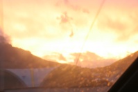
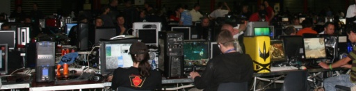
African Aerospace and Defense Expo 2008
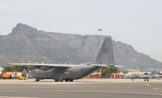
Members of spineFORGE and tinysquishy visited the annual African air extravaganza yesterday. It was a great show with amazing flight displays and equally varied and interesting exhibition stands from all kinds of companies and organizations.
We visited on Sunday (the last day of the week-long show) and although things were winding down, all evidence pointed to a show on a much larger scale than in previous years. We got lots of cool photos and greatly enjoyed ourselves - the high-speed vehicles, large crowds and hot sun helping to keep our minds off the very confused and uncertain local political situation.
A more detailed review and photo essay will follow shortly...
4 September 2008
Happy 25th Birthday GNU!!
The GNU operating system project, begun by Richard Stallman (founder of the Free Software Foundation), celebrates it's 25th birthday this year. Visit http://www.fsf.org/news/freedom-fry to see a video by Stephen Fry, the popular media celebrity, introducing the project to those who might be unfamiliar.
15 June 2008
Winter Developments
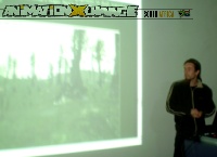
I attended (and gave a presentation at) the most recent AnimationXchange meeting on Thursday the 13th of June. This monthly event is an informal get-together of Cape Town industry people and interested enthusiasts with presentations, chats and wine.
Thanks to everyone who braved the miserable winter weather in Cape Town this month to get to the exchange. It was nice to join you and get out of the flat for a while.
The coolest part of the event for me was watching the amazing new Blender Foundation animated movie, which was entirely produced with Free and Open Source Software (FOSS), which is quite a thing for independant creators to think about.
The movie was very polished and the characters really drew you in. The animators and editors succeeded in getting across a lot of emotion, an achievement which requires decent tools and loads of talent.
This particular meeting was one of the first official "GameXchange" editions that appear to be a reaction to the realization that real-time, interactive animation is gaining a place in the animation and other industries - alongside the usual pre-rendered, fixed-format films or advertisements.
 The event was very relaxed and we all learned a great deal about changes in the media workplace
(During talks about browser plug-in based game development (Flash etc) I really got thinking about the coming hardware-accelerated, client-side-storage-enabled, native-opengl-capable, optimized-javascript, Web-Browser-Apocalypse...).
The event was very relaxed and we all learned a great deal about changes in the media workplace
(During talks about browser plug-in based game development (Flash etc) I really got thinking about the coming hardware-accelerated, client-side-storage-enabled, native-opengl-capable, optimized-javascript, Web-Browser-Apocalypse...).
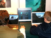
I gave my presentation after a break in the proceedings, introducing the spineFORGE website, some screenshots and the look of the reference documentation.
I also demonstrated the new Spine Viewer application and the tinysquishy "Bird of Prey" testbed game and tried to get across how achieving such results would be possible with very little developer effort.
The audience primarily consisted of animators from digital and traditional mediums rather than a more technical crowd, and I had no animations to speak of beyond helicopter blade rotations, so a talk about programming components was slightly out of place, but I tried my best to provide some insight from the perspective of a software developer and how programmers fit into the animation industry. Everyone seemed to enjoy the change from the usual stuff I suppose.
Another developer, Evan Greenwood, displayed a game called "Black Ships Fill The Sky", which was the coolest
looking Flash-based scrolling game I've ever seen, involving UFO's and spinning asteroids. This game
had an amazing feeling of depth achieved by clever graphics and really chaotic arcade gameplay.
Check it out: www.blackshipsfillthesky.com/blog
Coding Updates
I've been working very hard on the core networking functionality of the Spine system, including some production-level testing of the client-server event logic.
Unfortunately I've managed to get very little done in the way of graphics capabilities or a refactoring of my ancient sound module, but I've been concentrating on documentation a lot lately, with decent API reference material starting to build up to quite a critical mass.
As usual, I'm not going to say anything definite about release timelines - I was hoping to make it to the rAge Expo again this year in order to drop some surprises on the world but that's looking unlikely. All I can say is I'm burning the midnight oil to make something useful and fun. I want the first public alpha to be a solid base and direction for further development.
6 October 2007
rAge 2007 is finished...
...and we are back from Johannesburg exhausted, excited and counting down for next year!
The event was very busy from start to finish, and flew by so fast that 4pm came quickly every day. We had our fair share of hiccups: Windows re-installs, missing drivers, too few flyers and contact details to give out.
We also had too many people asking us if we were a printing company (we had lots of flashy posters), but on the whole, it was a very rewarding experience.
Thanks for the organizers for making everything relatively painless and special thanks to the Game.dev stand that really helped build excitement over local development.
Thanks also to Inky3D, who joined us at the expo, showing off their impressive real-time architectural walkthroughs.
 People were really happy to see that South Africans are having a go at game and technology development, and
it was really great to see kids happily playing our demo game, getting immersed in the virtual world we had built.
People were really happy to see that South Africans are having a go at game and technology development, and
it was really great to see kids happily playing our demo game, getting immersed in the virtual world we had built.
To see a detailed write-up of the 2007 rAge technology expo, held at the Northdate dome, visit the Tinysquishy news page.
Relevant Links
Here are links to various groups present at rAge 2007:
20 September 2007
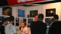
rAge!!!
spineFORGE, along with tinysquishy and Inky3D are teaming up to show some of our work to the world at the Tidemedia rAge technology exhibition taking place in the Northgate Dome in Johannesburg, South Africa on the weekend starting 28th September.
This event is kind of a South African version of a mini-E3 so geeks the country over are looked forward in anticipation to a weekend of gadget saturation, LAN games and all kinds of digital immersion.
Visit us at stand 7, near MegaROM.
Also, make sure to drop by the Game.Dev stand on the opposite side of the Dome from us.
The tinysquishy team and I have been in crunch mode for what feels like forever - we are seriously missing the sun, but it'll be worth it.
One more thing - Velociraptor had feathers!
08 November 2006
SAGameDev has some new clothes
Ye old SAGameDev has had some thorough upgrading via Korax and Nitrogen.
Totally new backend, forums and graphics and even hosting. Check it out www.sagamedev.com. Soon the site will host pages on featured projects and include revamped developer sections. Thanks guys for the hard work - I look forward to the future!
Tick. tick. tick. tick.

The spineFORGE website is one year old! Yeeps. Leeeeets dooooo the tiiiimewaaaarp agaaaain! Singularity - here we come!
20 October 2006
SPAM!!!
The Official SpineFORGE forums have been assaulted daily by spam since they went live. I've had enough trying to clear junk posts and dodgy users. I have disabled the forums until I can find better admin tools or a better forum. Sorry about any inconvenience - although I know for a fact that so far I've inconvenienced no-one but myself really ;)
16 October 2006
Rage
Oh well. I didn't get to Rage at the Northgate Dome this year - the premier digital lifestyle expo in South Africa. I would have loved to have a spineFORGE stand and display some demos, but the cost per square meter made it a little inaccessible. Next year - onward!!!
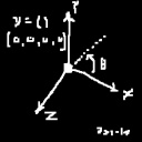
Quaternions invented on this day in 1843
The mathematical construct that gives us smooth 3D rotations without gimbal lock problems - Quaternions - were invented on this day 163 years ago. See Wikipedia for more info : Wikipedia: Quaternion
26 September 2006
African Aerospace Exhibition
Check out the [Tinysquishy News] page. I have posted an article with photos detailing our trip to this most exciting event. Lots of high-tech military hardware and great aerobatic displays!
Links
Also, I've added a large selection of links from my internet wanderings [here]. Enjoy!
11 September 2006
Virtual Reality News:
Linden Lab's Second-life virtual world has been hacked. All client passwords have been reset and users will have to re-register new passwords. This is yet another warning to anyone who thinks their digital lives are your little secret. My take on it? I think the world-wide-web, immersive virtual worlds and many other digital technologies are here to stay and something we all have to face at some point - but are not something we should be commiting our entire lives, happy memories, bank accounts and friendships to. These are young technologies that we are still adapting to as a culture. Have fun - but be careful.
[Second Life Announcement]
Digg report: [Comments]
The Gigapixl Project
This project is focused on creating ultra-high resolution, land-based images.
I want one of these cameras for capturing textures for virtual realities!
"Weighing more than 100 pounds, the camera captures images at 4 gigapixels -- a resolution high enough to photograph four football fields and capture every single blade of grass. a real-world 90-degree panorama would need to be searched with 12X tripod-mounted binoculars before one could hope to accumulate an equivalent amount of information. "
[Official Site]
[Cliff Sailing Image]
Japanese Politician woos the geeks
Check out the UNIX command lines in this campaign ad:
[% man politics]Virtual reality for stroke rehabilitation
Immersive environments can play important medical roles [Virtual reality therapy]
2 September 2006
Heres some interesting links for you to check out:
ASCII Maps - A GoogleMaps-like page with scrollable ASCII-drawn world maps! [ASCII Maps]
Firefox Market share increasing: [W3 Counter - Web Statistics]
Digitally Distributed Environments Blog: [Virtual Cities]
Microsoft Flight Simulator - watch out Google - this is your virtual earth's greatest competition:
Comparison 1
Comparison 2
Comparison 3
The $100 Laptop is coming along well: [Laptop Pics]
Need space anyone?: [16GB Flashdrive!]
Add your own interesting links to our forum: [spineFORGE Teleporter Room]
17 August 2006 - (2)
Proposal to change (or at least solidify) the definition of "planet"!
We might soon officially have 1000's of planets in the Solar system. Cool.
Wikipedia article
11 August 2006 - (2)
New Forums!
A new forum system courtesy of phpBB has been installed on the spineFORGE site! This forum can host your discussions about spineFORGE technologies. Forum sections for News, a Lounge, Projects and Partners are available. Enjoy!
Link to spineFORGE forums
11 August 2006
Open Source Common Sense
Recently (and supposedly very behind schedule) the OpenCyc package has been released. This is an attempt at storing a large common sense and reasoning database of ontologies. Theoretically this kind of information could be used by intelligent software to make decisions and analyse data.
Check it out here: OpenCyc home Page
Here is the slashdot discussion: Slashdot on OpenCyc
10 August 2006
Don't be Evil
This is more of a comment than a news item.
Currently there is a lot of banter on the Internet about on-line security, tracking of searches and individuals, Big Brother watching us etc.
Adding fuel to the fire AOL recently released a whole bunch of search query data that can and is being used to
discover individual search activity. See here:
Defensetech article
SecurityFocus article
Inquirer article
Slashdot conversation
Many people quote Google's informal catch phrase "Don't be Evil" and will be very quick to point it out when they feel Google does not live up to this mantra, as though it was a statement of Google's intention or business policy.
Rather, I believe this is a warning to all us Internet users out there to be careful about what we do or say on-line as even simple Google searches can be used to find out lots of important information about a person. The world is moving towards becoming a very open, transparent system that will be very difficult to interact within with any secrecy. Search Google for information about me: Chris Rose-Mathew
I have been thinking recently about the implications of Totally Open Source Business - where every meeting, every policy decision, every transaction, is made totally public. Seems pretty Star Trek huh?. This would have lots of positive effects, but I'm sure it would also deeply insult anyone currently seeking market advantages by being closed to the world. What does this Open Source movement (in a greater arena than just software development) mean to capitalism, politics and economics? Beats me - but it will be interesting to watch...
08 August 2006
Canada - Part 1
I recently spent one week in Vancouver, Canada at a business conference courtesy of my employer, ComputaMaps.
The conference focus was the "Geoweb" - the coming together of geographical information systems and the internet. It would be a point of presentations by industry leaders, as well as a hub of discussion and technical workshops dealing with the relevant technologies. It was an amazing stay in one of the most beautiful places I have seen or can imagine. I met lots of great people and the proceedings were much fuel for the overactive mind. This post will detail my adventures overseas rather than the technical aspects of the conference itself:
By the way - I, Chris, am angry and moving through the Atlantic gaining strength!
Check out:
http://www.gearthblog.com/blog/archives/2006/08/tropical_storm_1.html
My Vancouver Trip
I'm back from Vancouver, Canada and just getting over the Jetlag - I took half the day off yesterday to get some sleep...
My trip was absolutely awesome. One of the most beautiful places I've ever laid eyes on. The city is so clean and spatious, there are no real transitions from city centre to suburbs, it kind of just seamlessly turns into living space. Lots of wide, tree covered sidewalks filled with people walking, skating, cycling and jogging.
Unusually, from what I could tell - about 60% of the population is Asian and the place is all china-town with noodle bars and sushi restaurants everywhere. Everyone I've bumped into is friendly and welcoming. It is summer holidays for the locals and that means 4 months of fun in the sun - and everyone was taking advantage.
The in-bound flight
The flight over there was in two legs - SAA to Heathrow, and then Air Canada to Vancouver. Total flight time was 21 or so hours. My bony butt was not impressed. On the second leg I had a young swedish guy who works on an Oil-Rig doing arcwelding and abseiling tell me stories of his global adventures, which was very interesting. We swopped email addresses. Hopefully he will be able to help us flesh out details of Tinysquishy's first game, Deep Pressure!
Going there we flew north out of London and headed via great circle over Greenland and into Canada from the north over Hudson bay. As we reached Greenland at midday (actually, the entire 9 hour flight was at midday since we were chasing the sun around the earth - the flight took off at 12am and landed at 2pm, only 2 earth hours later! I'm a time traveller as well as a tropical storm!) I saw large, shining white ice-bergs and then huge splitting iceflows!
Over greenland there were many glaciers of various sizes arcing over the escarpment and crashing into the sea. It was an amazing site from 40000ft.
Northern Canada was a massive wasteland. Just rocky, barren lowlands and ice lakes for miles and miles in all directions. Not a sign of humans at all. No paths, roads, or buildings of any kind. Just how it should be...
Finally, we started to see the Rocky mountains ahead, then great forests and snow capped peaks. Once we were over British Columbia (the Canadian province containing Vancouver) it was just beautiful. It was perfect Late Cretaceous T-Rex dinosaur land. Huge cedar and pine trees, green ferns and volcanic peaks. We landed at the very pretty Vancouver airport and got out of the plane to very Cape-town like summer weather.
Arrival
It was Sunday afternoon and the conference would begin the next day. I got into relaxed clothes and after unpacking in the hotel room, hit the streets to check out my surroundings. I found very quickly that the Ramada suites hotel was right in the centre of Vanouvers' red light district with Sex Shops, Tatoo parlours and Peepshows all the way up the road. No getting bored after hours here! I found the Vancouver Rock Shop with lots of studded gothic gear as well as an awesome CD store, HMV, where I would later buy presents for all my buddies.
The actual floor exhibition would take place on the final 3 days, so it was only workshops and panel discussions for Mon, Tues and Wed. My ComputaMaps colleagues would only get there on late Wed, to set up for the floor show. Meanwhile, Steven (business sales manager) and I explored a little, checking out GasTown, the oldest part of Vancouver where we found a Steam-powered clock that puffed out musical tunes every 45 mins!
We ate huge traditional burgers for a late Lunch and I found out that Cola Tonic is not available in Vancouver! Obviously it's a Third-World delicacy only...
Later that evening, I bought my first Burger King Whopper (YUMMMM) and then headed home to sleep.
The conference begins
The next day was the opening of the conference.
I got dressed up in slightly less casual gear and donned my company name tag and made it to the registration. I receieved a sponsored Microsoft bag and all the timetables for the events.
I went to my first half-day workshop - Google Earth and KML (a language for describing geographical things for Google Earth to display, such as buildings and places). This workshop was to be presented by Michael Ashbridge, Google KML data engineer.
Also present was Micheal Jones, CTO of the Google Earth team (and also head developer of OpenGL I found out later!) as well as Bent Hagemark. To my surprise, it ended up that they used ComputaMaps' Vancouver 3D model to introduce the capabilities of the Google Earth application! This model is one ComputaMaps had done for promotion just before the conference, so it worked out perfectly!
I asked some questions that won me a participation prize - a Google T-shirt (which was WAY too big for me - so Sarah has a Google Earth nightgown now!)
I also handed in my ideas for reorganising the program's data layers and that impressed Micheal Jones, the Google Earth Chief so much he gave me a magnetic desk-globe paperweight thingy that supposedly only the developers themselves have - very cool.
I chatted to some friendly students from Vancouver as well as a researcher, Tim Martin from the UK Ordance survey - the national mapping agency) who was also creating KML buildings for Google Earth.
Nightlife
That night I hit the town. I basically just walked the city from end to end (the first of many times) and checked out the sights. Huge glassy, reflective buildings, fancy condos and lots of trees. The seagulls in Canada are HUGE and much louder than the local ones, although their cry sounds exactly the same.
I found out that Vancouver runs electric busses that are powered by overhead cables like electric trains, although they can be freely steered. They make zapping noises as they move about. I scouted out the locations of all the major services and shops.
Day 2
The next day was a presentation of Microsoft Virtual Earth, a competitor to Google Maps.
I didn't learn too much here, but did get an idea about where they are going with things - turning Maps into a developer platform, and similarly to Google, creating a new geographical interface to applications.
After this workshop I left the conference centre (which was a University building with a UN-panel-like circular conference room with microphones for everyone and push-to-talk buttons.) See here:
Stefan Lorimers Blog
I walked downtown to the huge forest reserve, Stanley Park, a stand of pine, cedar and other large conifer trees that is surrounded by a 10km skate/walk/ride path and is crisscrossed by dirt walkways that surrounds you with amazing green sights.
In the centre of the park is lily-covered Beaver lake and an aquarium that contains Beluga whales. Unfortunately I didn't have time to check this out as I realised I had gotten very deep into the Jungle and it was already 10pm (although not dark yet as there is still light in the sky at 11!)
I managed to make it out into Robson street (Vancouver's Long street equivalent) and into a noodle bar for some late-night Chow mein. After that I continued my exploration of the night life. I found a small bar, bought some ale, and drew some monster designs until I got tired.
Day 3
The next day was breakfast sponsored by Autodesk and opening speeches by the Canadian Minister of Agriculture and Lands as well as Steve Lawler from Microsoft (towards whom I directed a question about community modification of virtual earth data - he didn't really make it clear as to what the average user will be able to build or modify within MS's virtual world. He described "head" data versus "tail" data. The tail being the "expert local knowledge" information provided by individuals and the head data being major infrastructure like satellite imagery, street data and building models. This as opposed to Google, who are actively promoting the average user as a content-provider - even up to 3D models and massive image overlays). Overall though, it was a very good keynote that whet our appetites for what's to come from Redmond and opened minds as to the issues we all have to face as these immersive digital environments are created..
I went to workshops and panels about Geographic Data security, GML, Web Services, Simplicity trade-offs and data query languages. Lots of fun and interesting stuff.
I also met and talked to the head of a company who does 3D building models for computer games, visualization and the US army special forces - David Colleen of Planet 9 Studios. Planet 9 were the first ever company to create on-line 3D content.
That night I went to bed early. Kinda.
Part 2 of Vancouver Trip
Wednesday evening was an awesome, very new experience. Paying conference attendees were invited to the marina to board the Britannia - a medium size cruise ship decked out with restaurant tables, bars and a viewing deck. We were to embark on a trip around the harbour as well as Stanley park to view the opening night of an international fireworks exhibition just like our local Symphony of Fire. Italy was the performing country and ALL of Vancouver seemed to be out to watch.
At about 7pm all of us boarded the ship and headed straight for the sponsored bar. We collected our drinks and everyone began mingling and chatting about the conference, their work, and about Vancouver in general. Everyone I talked to was amazed by the distance we from ComputaMaps had come - after all, South Africa is almost an Antipode of Vancouver - on the opposite sides of the planet.
Check out : Wikipedia:Antipode
We had a great buffet dinner and discussed 3D building databases - part of the product ComputaMaps was here to show off (check out the ComputaMaps Vancouver 3D model here):
ComputaMaps on Google Earth Blog
and here:
Cape Town in 3D
It was great fun to mingle with so many important names in technology, and - not that I'm any kind of conniseur - the Canadian beer was good too.
Once we had digested supper, we were called to the upper deck to watch the fireworks display (which started at 10:30pm to allow the light to fade enough). Our ship had travelled to the South end of Stanley Park and we had an amazing panoramic view of the city which would frame the display.
HUNDREDs of other watercraft had started surrounding us in anticipation for the show - even groups of Police boats weaved their way through the crowds, keeping everyone well-behaved. Every radio station in Vancouver apparently tunes to the music for the show, and then it started...
The show was 25 minutes of massive explosions and bursts of light - all syncronised to the music. It was really impressive. To add the blinding show, were thousands of camera flashes from all over the city - from every skyscraper and parked car. It was a great evening.
When it was over and our ship had docked, we made our way back through the humming crowds to our hotel and crashed. Into bed that is.
Day 4
The next day I woke up a little late to see the daily opening remarks. I made it down to the floor exhibition where my colleagues had set up the ComputaMaps show stand. We had a 3-monitor computer setup with a panoramic Google Earth displaying the Vancouver buildings. Everyone who saw it was very impressed and struggled to believe it had been built using photogrammetry without stereo-pair images (which allows easier discovery of building heights).
I checked out the other stands quickly - Microsoft, Autodesk, Lockheed Martin, Galdos Systems, ESRI, Google and others all had very interesting displays and brochures explaining their wares. Great food was served here for lunches.
I made my way upstairs to get to the technical workshops of the day - the most interesting of these being talks about the possibilities and limitations of GIS systems over the internet, as well as very good panel discussions on virtual worlds where all involved could participate and pose questions to industry leaders. Some thoughtful questions about environmental awareness and conservation were asked.
Later in the day a workshop on .NET and OGC technologies was cancelled so I took the opportunity to go back to the show floor and investigate some more of the companies and products.
At the end of the day was the exhibitor reception where good food and drinks were served. Gifts were handed out to important conference contributors and we at ComputaMaps planned our crazy Friday itinerary.
Day 5
Friday was our last day in Vancouver and a very busy one. We would only see the first half of this last day of the conference. Early in the morning was the keynote speech by Micheal Jones of Google Earth who discussed his vision for GE as a means to information discovery and for planetary awareness. He showed new imagery of war-torn Beruit to drive home his point. He explained how he wanted to leverage the worldwide communities as "local experts" to fill the gaps in information and content that Google couldn't provide (Look at www.reddit.com or www.digg.com for similar ideas in the different context of community-provided news). Google Earth is well on it's way to becoming the wikiWorld that all us 3D-engine builders fear...
After the Google presentation, was Gary Lang, Vice president for engineering at Autodesk who gave a very interesting talk on how the OpenSource philosophy is affecting software develoment and business processes.
Where does the money come from?
After this my bosses headed down to wrap up the floor show while I remained to listen to a talk about the design of a new integrated system for the UK Met office. Then was an important panel discussion - "Geoweb, where does the money come from?".
This was entertaining - lots of "umms" and "aahs" and "I don't know"s. The world of software and technology is always very fickle, with disruptive change continually requiring fast evolution and adaptation from parties involved. The panel discussed different payment methods as well as how they envisioned (or could not envision) how money would flow through the infrastructure being built up around the new technologies.
That was the last of the conference for us, we packed up the floor stand and packed our bags and made it back to the hotel to prepare our things for our departure. The actual departure would have to wait for one final tour of the area - from the sky!
Canyon flying!
My boss George had organised a flight in a small floatplane called a Beaver up the rivers, valleys and creeks of the local mountains.
We took off from the harbour waters gently but loudly, the 1952-vintage aircraft humming away. We flew over the north-western shore of the harbour and then turned north into the mountains where we were greeted by amazing views of very tall trees, beautiful waterfalls and steep snow covered cliffs.
Our pilot tried to make it to a nearby glacier, but clouds barred our entry into a tight valley, so we made an exciting turn to land in a quiet mountain lake.
We discussed our options and decided to head further north to see what is reputed to be the fastest moving salt water in the world, a set of rapids with foaming whirlpools just inland.
After this trippy sight we made our way back to the harbour and enjoyed a spectacular city view and a bouncing water landing! We quickly disembarked, thanked our friendly pilot and rushed to our taxi.
From one plane to the next, we got to the airport and started the loooong process of getting back to Cape Town.
I won't go over the details of the flight, but I did enjoy a lightning tour of London during the wait for our connecting flight, George booked us on the metro into town for a trip on the London Eye as well as a ride on one of the famous red double-decker busses. I saw the imposing Big Ben as well as the parliment buildings I had just watched explode in the movie "V for Vendetta".
Back home
Soon, (or not quite so soon), I was back in good old Cape Town, South Africa. Soft mists and grey skies awaited us, but it was a welcome change from the stuffy high altitude sardine tin we had been in for 20 or so hours.
I had an amazing time in the northern hemisphere and I hope to return ASAP. I thank my employers at ComputaMaps for providing this awesome opportunity to see more of the world and learn new things.
Here are some links to people and places I saw or met while overseas:
Stefan Lorimer, friendly graduate from Simon Fraser University who voluteered to help with running the conference:
http://meharties.blogspot.com/
Tim Martin from the UK Ordnance survey:
http://spatiallyinterested.blogspot.com/
Planet 9 Studios (3D cities):
http://www.planet9.com/
Earthdetails (startup building a terrain engine):
http://www.earthdetails.com/
Immersive Media (crazy 360' cameras):
http://www.immersivemedia.com/>
Snowflake Software (XML/CityGML tools):
http://www.snowflakesoftware.co.uk/
Google Earth:
http://earth.google.com/
Google Maps:
http://maps.google.com/
Microsoft Live Local:
http://local.live.com/
and of course, ComputaMaps:
http://www.computamaps.com/
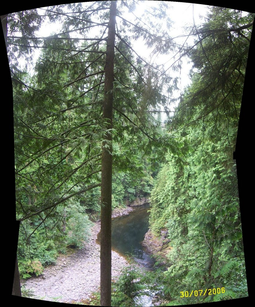
Picture of the forests of Vancouver taken by Tim Martins:
http://photos1.blogger.com/blogger/7610/3461/1024/pano_capbridge.jpg
04 August 2006
This was the idea that won me the Google Desk Globe Puzzle mini-prize from Micheal Jones, CTO of the Google Earth Team I mentioned before:
As much as Google Earth is one of the most amazing pieces of software ever written - I've always disliked the layer options and how they are laid out.
I'm a big User Interface/User Experience geek and very quickly spot things like incorrect capitalization and have very strong ideas about tree hierarchies. Some would call it nit-picking.
These are the current Google Earth data layer options. Turning these things on or off allows you to toggle the visibility of various items in the 3D view.
Primary Database
( ) Terrain
(+) roads
(+) borders
(+) Populated Places
(+) Alternative Place Names
( ) 3D Buildings
(+) Gas food and lodging
(+) National Geographic
(+) GE Community
(+) Shopping and Services
(+) Transportation
(+) Geographic Features
(+) Parks and Recreation Areas
(+) Community Services
( ) DG Coverage
Here again with important items exploded to show what further options they contain:
Primary Database
( ) Terrain
(+) roads
Huge list different roads in various places
(+) borders
Different types of borders
(+) Populated Places
Capitals
Major Cities
Cities
Cities/Towns
Towns
Villages
(+) Alternative Place Names
Different Language Options
( ) 3D Buildings
(+) Gas food and lodging
Dining
Coffee Shops
Bars/Clubs
Lodging
Gas Stations
(+) National Geographic
Different types of content
(+) GE Community
Forums
Showcase
Unranked
(+) Shopping and Services
Grocery Stores
Movie Rental
Pharmacy
Banks and ATMs
Shopping Malls
Major Retail
(+) Transportation
Airports
Rail
(+) Geographic Features
Volcanoes
Mountains
USA Features
Water bodies
Earthquakes
(+) Parks and Recreation Areas
Parks/Recreation Areas
Sports Venues
Golf
(+) Community Services
Schools
School Districts
Churches/Cemeteries
Fire/Hospitals
( ) DG Coverage
Things I dislike are "borders" and "roads" uncapitalized, some redundant items in Populated Places and Parks/Recreation, minimal transport options, and the very obvious "Geographic Features" - isn't everything in here a geographic feature?
Anyway this is basically what I proposed: The root of the layer tree should be a simple binary option: Natural or Man-made.
(+) Natural
(+) Man-made
Then each of these further expands to a logical breakdown with an attempt to minimize redundancy and maximize discoverability:
(+) Natural
(+) Mountains
(+) Geothermal
(+) Volcanoes
(+) Active
(+) Dormant
(+) Undersea Vents
(+) Water
(+) Rivers
(+) Lakes
(+) Swamps and Bogs
(+) etc.
(+) Man-made
(+) Borders
(+) International
(+) Provincial
(+) Municipal
(+) Populated Places
(+) Cities
(+) Towns
(+) Villages
(+) Informal Settlements
(+) Campsites
(+) Transport
(+) Roads
(+) Interstate Roads
(+) Main Roads
(+) Side Roads
(+) Dirt Roads
(+) Hiking Trails/Paths
(+) Railways
(+) Doubletrack Mainlines
(+) Mainlines
(+) Branchlines
(+) Stations
(+) Freight Yards
I think things like Alternative Names and 3D Buildings (3D Objects!) should be seperate options.
I'm sure this is the intended direction for Google once they have enough content to start organising things better - it is early days yet.
In terms of information hierarchies - this is one of my favourite topics, and a large reason I am building the Sprawl system, which allows programmers to lay out the structure of their own virtual reality.
Thanks Google for the great presentation at the Geoweb 2006 conference, I enjoyed it immensely.
Micheal Jones is a great speaker and I think he will be an instrumental force moulding the changes in store for the human race...
I heard many good speakers at the geoweb 2006 conference. I really enjoyed Gary Lang talking about Open Sourcing select Autodesk products.
Some of the more technical presentations were also varied and informative. One must learn to cope with accents of all kinds. The distribution of the attendance was made clear by a paper map with pushpins that everyone had placed indicating their origin that was standing in the entrance hall to the venue.
03 August 2006
August already?!
Jean-Pierre and I have recently found out the Talentshack website is down and gone forever (at least at the current domain). The domain and site was hosted by a friendly agreement rather than money and contracts, so we have no real control over the circumstances. We will do our best to get a new forum up and running ASAP - with a reliable paid hosting service.
In terms of my recent Vancouver trip - I am halfway through a large report that I will publish here for your viewing pleasure as soon as it's done.
In other news - check out the NAG website for information about a new sponsored game development competition!
NAG Home page
25 July 2006
I am writing this news article in an internet cafe in Vancouver - I am visiting the 2006 Geoweb conference on Internet mapping technologies. The event is sponsored by heavyweights such as Microsoft, Google and Autodesk. I've personally met the CTO of Google Earth, Micheal Jones as well as many other notables in the geospatial world. I even won a T-shirt and Google Earth Globe puzzle when I submitted my ideas for re-organising Google Earths data layer heirarchy! Anyway the main reason for this post is to point you to this link:
www.tinysquishy.comThis is the new website for Tinysquishy Development, the game development team I have been trying to get together for quite some time now! Tinysquishy will be the first company to use the Spine framework to develop digital immersive products. Enjoy the site. More about it soon!
19 June 2006
The Flash Worldkit system has been temporarily removed from the contact page while I figure out a neater way to integrate it into the page itself, as well as provide some updated data-points.
16 June 2006
My original plan was to release Spine as a single module
with all it's major components ready and included.
I have decided to be just a tiny bit less ambitious and release a
small core set of the better documented components for public
alpha review.
This core will form the basis of the operating system access
functionality as well as the Client/Server framework.
Things like graphics and surround sound will follow once
their implementation becomes more concrete and modular.
I've been getting me overly stressed about getting things just right -
but in the end public criticism is the best way to open the doors to
improvement.
This release will be a look into where Spine is going in terms of
API design and documentation, but it is in no way a final set of
components. I have been rethinking Sprawl's place in the world and I'm wondering
whether or not it is pointless to seperate scene-graph from rasterizers...
I will be initially releasing compiled DLL binaries for
Microsoft Windows. They will come packaged in a "mini-SDK" with
documented include files, import library, and HTML API pages.
The list of components to be released will be something like the following:
- Server
- Client
- Console
- Text
- Address
- Message
- Finder
- FileReader
- Configuration
- Timer
I have not decided on licencing details yet - for now I'll leave it as "ONLY NON-COMMERCIAL USE IS ALLOWED UNLESS THROUGH SPECIAL AGREEMENT WITH SPINEFORGE."
10 April 2006
The free Worldkit flash system has been embedded into the spineFORGE [Contact] page. This great tool allows you to embed streaming, hi-res global earth imagery into your
website.
Worldkit and it's documentation can be found here :[Worldkit Home]
The newly designed spineFORGE site will be ready soon. Keep an eye out.
spineFORGE is the focus of a pending first article from the new industry site [www.gamedev.co.za]
1 November 2005
spineFORGE, a technology developer specializing in interactive real-time multimedia, is developing SPINE, an integrated framework of software libraries, tools, documentation and surrounding services designed to allow the simple construction of immersive digital environment applications for education, entertainment, training, presentation and simulation. Users of our products would include visualization builders, broadcasters, teachers and students, film and music-video producers, game developers, artists, private hobbyists, experimenters, and as much as possible - the general public. The developer will focus on integration of a wide variety of existing technology to achieve it's goals, as well as build new technologies and techniques that emphasise simplicity, ease of use, reliability and affordability - while publishing as much tutorial information and presentation material as possible about the work, to furnish further interest and co-operation in such efforts.
SPINE is the first release in a set of 3 core component packages that simplify the task of creating immersive applications.
SPINE
SPRAWL
SURVIVAL
Sprawl is a high-level scene interface, based on scene-graph principals. It allows you to contruct environments using a simplified object-orientated methodology of world-building, "TAO":
First you lay out the TYPES of things in your world, then decide on the ACTIONS that affect them, then lay out the OBJECTS in the world. Once you have done this,
a simulation of the situation can be started and
interacted with.
SURVIVAL is a planned artificial intelligence framework for building interesting and exciting behaviour into your world. Survival will control entitities in your digital environments based
on impulses, memories and various other aspects of the brain. You can use Survival to create realistic behaviour for artifical beings in your digital worlds, humans and other animals,
machines and effects.
Spine Composer
The glue that holds this all together will be the Spine Composer application, a dynamic, non-linear, non-destructive scene composer and real-time immersive digital environment builder. Built on Sprawl and the TAO methodology, the Composer will be a simple, flexible, powerful world builder for a new generation of digital creators.
[Frequently Asked Questions (FAQ)]
Use the icon to the right to check for errors on this page.
Email webmaster@spineforge.net if you find any.
![]()
All content copyright (c) 2005 Chris Rose-Mathew (www.spineforge.net) unless otherwise specified